
Melissa strengthened into a Category 3 hurricane Saturday and is expected to continue intensifying over the weekend, becoming a Category 5 storm — with winds up to 160 mph — before making landfall over Jamaica on Tuesday morning, according to the National Hurricane Center.
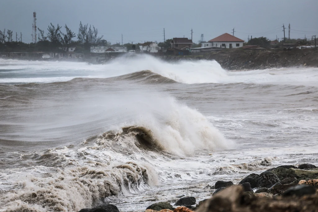
Melissa is expected to hit the Caribbean with heavy rain, life-threatening flash flooding and destructive winds. Low wind shear and very warm ocean temperatures are making for a perfect environment for rapid intensification over the next 24 hours.
As of 11 p.m. ET Saturday, the National Hurricane Center reported Melissa was about 125 miles off the coast of Kingston, moving west at 3 mph with sustained winds of 115 mph.
The center said residents of Jamaica should seek shelter and prepare for multiple days of heavy rainfall and damaging winds that could cause life-threatening flash flooding and landslides.
Potentially deadly flooding and landslides are also expected in Haiti and the Dominican Republican next week as the storm tracks northward.
It’s expected to be a multi-day major hurricane event for Jamaica lasting through Tuesday. A major hurricane lashing the island for so many days will lead to extensive wind damage and widespread power outages.
This could be the strongest hurricane to impact Jamaica in more than 35 years. Hurricane Gilbert in 1988 was a Category 4.
Melissa is expected to move slowly in the Caribbean Sea on Saturday into Sunday, allowing the storm to take advantage of very warm waters, as well as the decreased wind shear, and rapidly intensify into a major hurricane.
Hurricane conditions are expected in southern Haiti later Saturday, reaching Jamaica later in the day and continuing into Sunday morning.
The storm will be near the island from Sunday through at least Tuesday, creating a multi-day event of heavy rains that could lead to catastrophic flash flooding and landslides, as well as extensive damage from damaging winds and life-threatening storm surge.
This may also deal a heavy blow to the energy infrastructure in Jamaica, possibly leading to widespread and long durations of power outages.
With this storm expected to move slower through Jamaica, as well as track at a more impactful angle from the south, Melissa has a chance to surpass the impacts seen from past hurricanes like Gilbert.
Hurricane warnings are in effect for Jamaica, while hurricane watches remain in place for Haiti’s southwestern peninsula, from the Dominican Republic border to Port-au-Prince.
Between 15 to 25 inches of rain are expected across portions of southwestern Haiti and eastern Jamaica through Monday, with locally higher amounts possible up to 35 inches.
The rest of Haiti into the southern Dominican Republic are expected to see 6 to 12 inches of rain. Significant, life-threatening flash flooding and numerous landslides are a possibility is all these areas through the weekend into early next week.
After moving north of Jamaica, Melissa is expected to cross southern Cuba and reach the central or southern Bahamas by Wednesday or Thursday before turning northwest toward the central Atlantic later next week.