Two major storm systems are threatening the US this week.
A massive, multi-hazard storm was barreling east across the country Tuesday, impacting much of the central and eastern US and threatening the South with strong tornadoes and flooding and parts of the Plains and Upper Midwest with ice and snow.
And as California recovers from the weekend’s deadly floods, a second storm system is coming onshore that’s threatening the state with powerful winds and more flooding, triggered by both the expected rainfall and the state’s already wet soil.
“Major wind and rain impacts are EXPECTED tomorrow into Thursday. Prepare now for flooding, downed trees and power outages,” the National Weather Service in San Francisco warned.
Meanwhile, the storm system that’s tracking east is pulling moisture from the Gulf of Mexico into the South, where above-normal temperatures have set the stage for severe thunderstorms.
By Tuesday evening, several areas were reporting record-high temperatures. Mobile, Alabama, tied its daily high temperature for January 3 with a high of 79 degrees Fahrenheit, a record set in 1989. And Pensacola, Florida, broke its daily high record for January 3 with 81 degrees Fahrenheit, beating the prior record of 79 set three years ago.
30 million under weather threats, including tornadoes, flooding
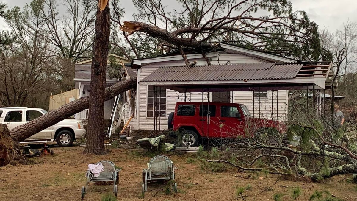
Nearly 30 million people are under some sort of severe weather threat in the South, with the highest risk near the Gulf Coast. Southern Mississippi and Alabama were under a level 3 out of 5 “enhanced” risk for severe weather. Places like Montgomery, Mobile and Tuscaloosa could all see strong storms. A level 2 out of 5 “slight” risk of severe weather covered New Orleans, Atlanta, Birmingham and Baton Rouge.
On Tuesday evening, the weather service said it was monitoring two areas of thunderstorms that posed threats of wind and hail to the New Orleans area.
Tornado watches covered much of southern Alabama and Georgia Tuesday evening with additional storms developing in Louisiana and Mississippi.
Multiple waves of severe weather are possible in this region through the day, the Storm Prediction Center warned, “with the risk expected to persist well into the night across much of the area.”
Track the storm: Radar, weather alerts, travel delays and more
Strong tornadoes, large hail and wind gusts topping 70 mph are possible in the most extreme thunderstorms.
“Severe convection with all three modes (tornadoes, hail and damaging winds) is likely,” the National Weather Service office in Mobile warned.
As a storm system barrels across Central US with tornadoes, flooding and snow, another threatens West Coast with more floods